


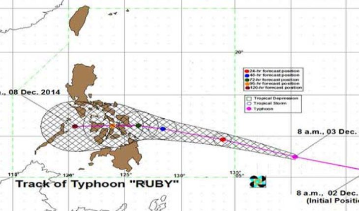
The Philippine Atmospheric, Geophysical and Astronomical Services Administration (PAGASA) said Hagupit was located at 1,543 kilometers east of Davao City at 10 a.m. today
Hagupit is bearing maximum sustained winds of 140 kilometers per hour (kph) near the center and gusts of 170 kph. It is still moving west northwest at 30 kph.
In a press briefing before noon, PAGASA forecaster Aldczar Aurelio said Hagupit will enter the Philippine Area of Responsibility (PAR) on Thursday and affect Eastern Visayas by Friday or Saturday.
Aurelio said Hagupit, which will be locally named ‘Ruby,’ will be slowing down as it moves closer to the country.
PAGASA is still looking at two scenarios for Hagupit. In a press briefing this afternoon, PAGASA deputy administrator for operations and services Landrico Dalida Jr. said there is now a 75-percent chance that the typhoon will make landfall over Eastern Visayas and a 25-percent chance that it will recurve toward Japan.
As per GMA News

Please Pray for the safety of our family in the Philippines.